


Poster Wrap - Cruchley's Plan of London
Poster Wrap - Cruchley's Plan of London
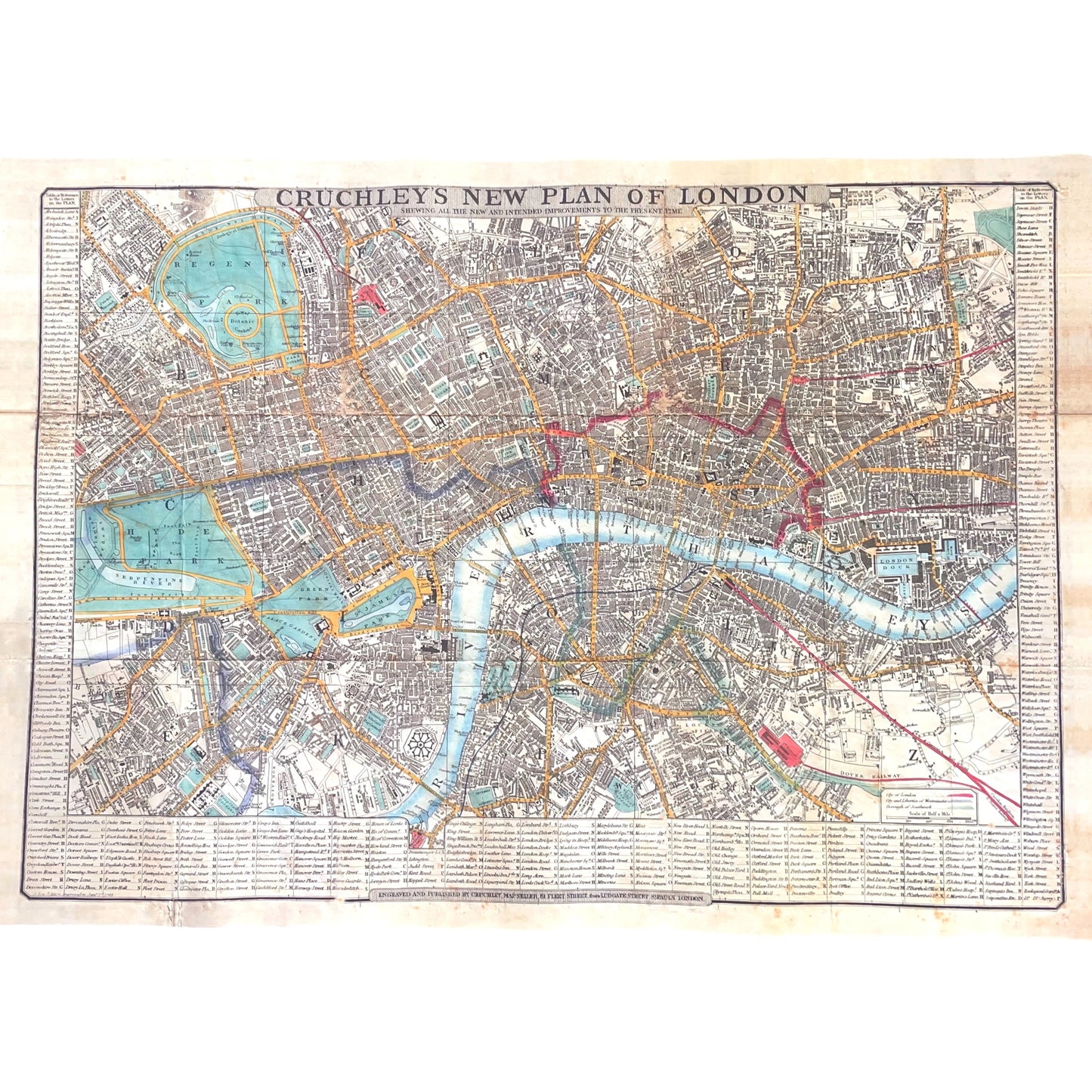
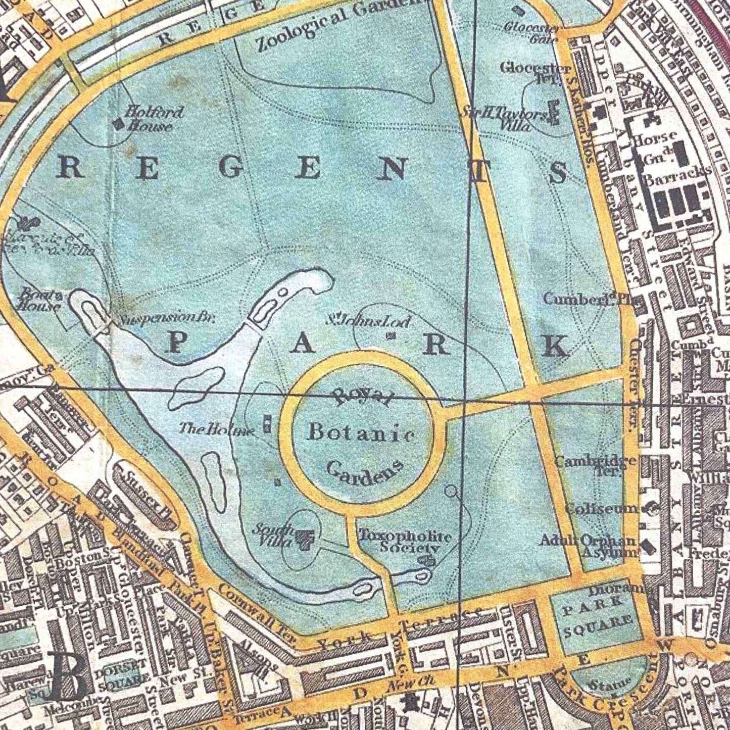
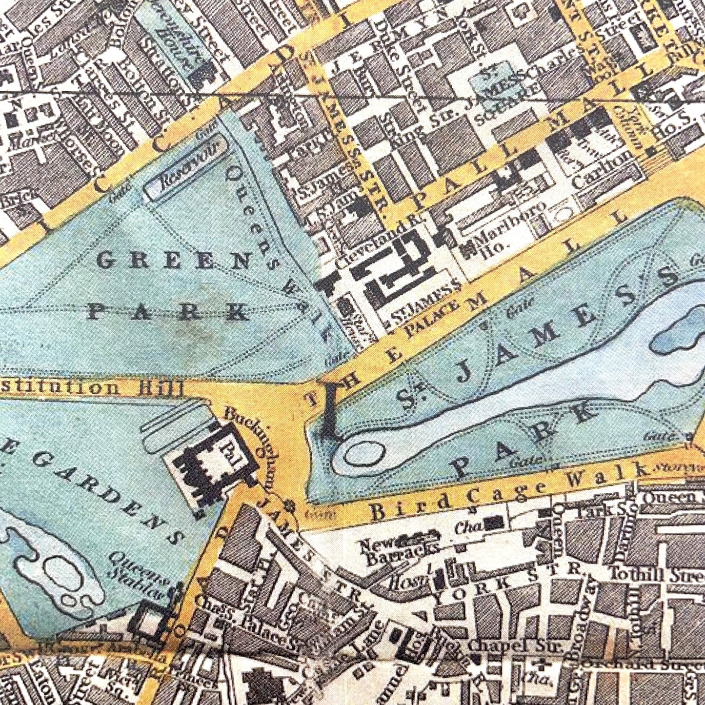
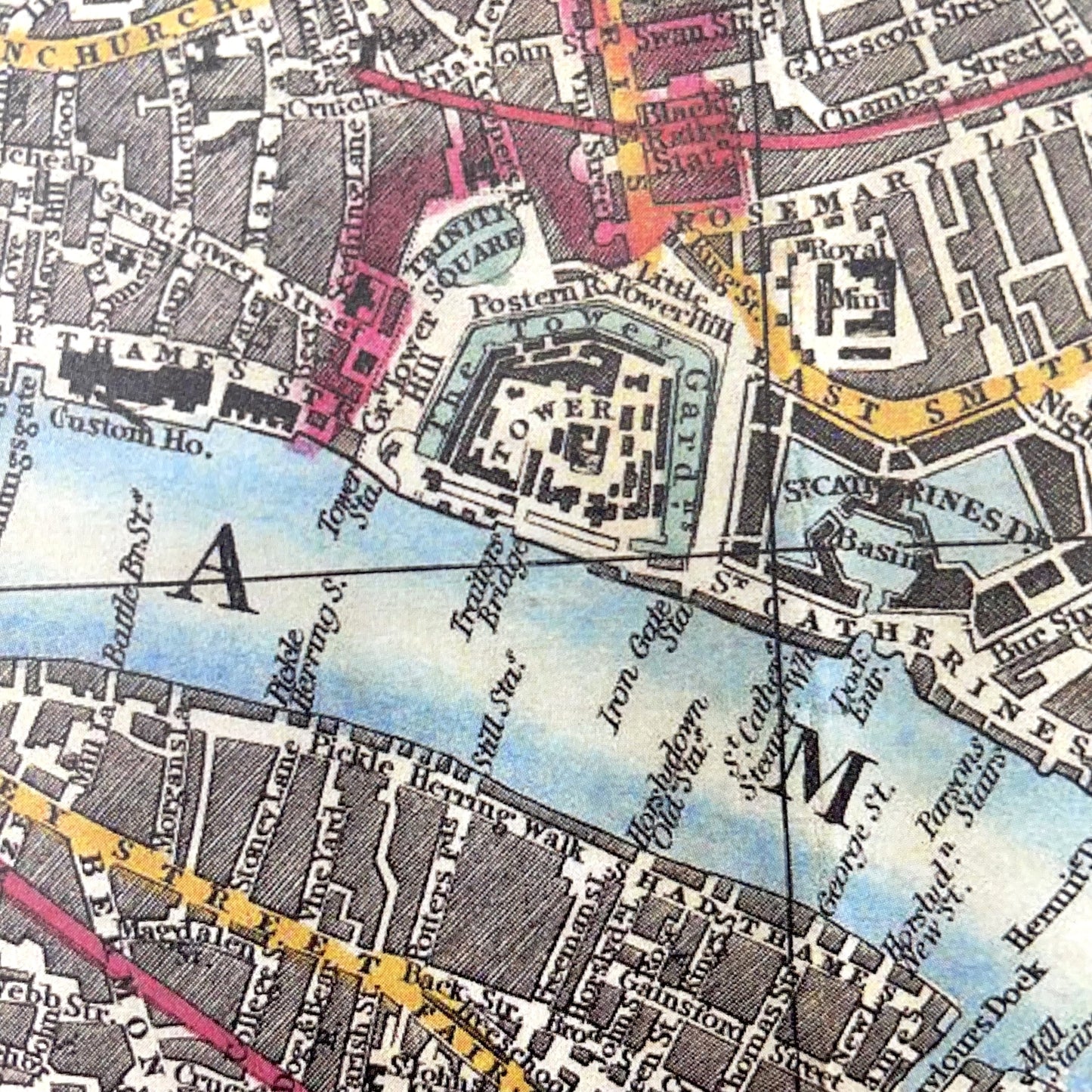
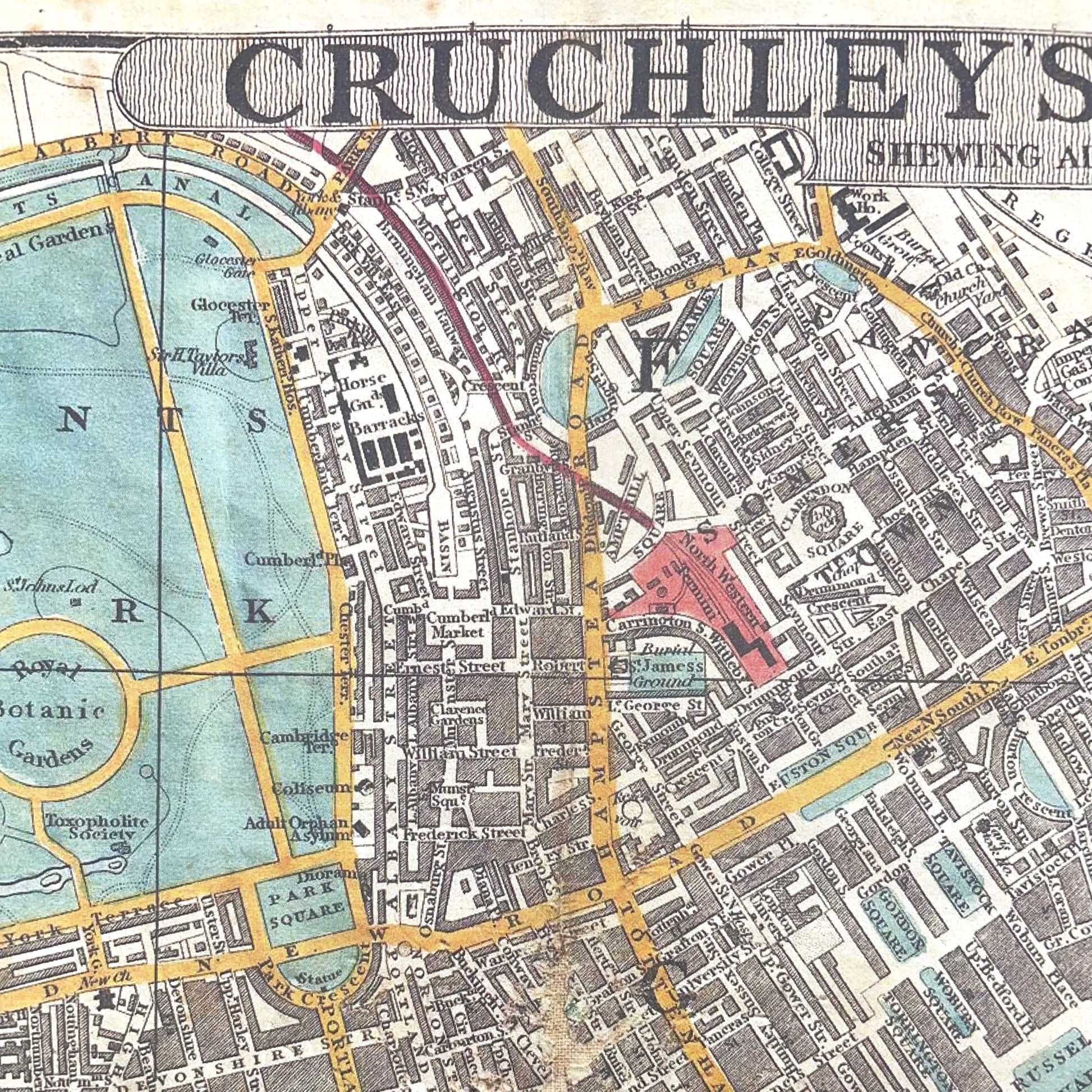
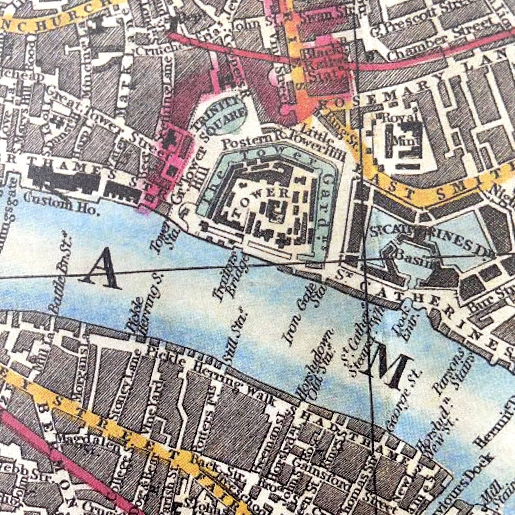
Adapted from ‘Cruchley’s New Plan of London, showing all the new and intended improvements to the present time’ (1848), courtesy of Geographicus Rare Antique Maps.
Map of London, extending from Hyde Park in the West to the London Docklands in the East, and covering Regent’s Canal in the North to Walworth in the South. George Frederick Cruchley (1797–1880) was a London-based book and map seller active in the middle part of the 19th century and was best known for his London maps.
Poster Wrap is such a versatile idea, use it for distinctive gift wrapping and paper crafts or frame/hang as a poster on the wall.
Printed with vegetable-based inks on a carbon neutral press using responsibly sourced, acid free paper.
700mm x 490mm
Delivered rolled
Designed and published by The Pattern Book.
Couldn't load pickup availability
Materials
Materials
Uncoated Italian paper, 90gsm
Dimensions
Dimensions
WidthHeight